How to Read the USDA Plant Hardiness Zone Map in Nevada
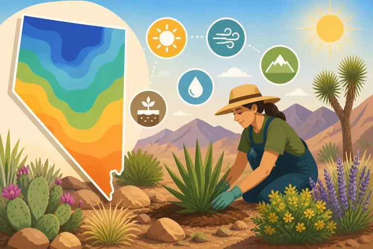
Nevada gardeners often look at a hardiness zone and expect it to tell them when to plant. The map answers a narrower question: whether a perennial is likely to tolerate the winter cold associated with a location. Here’s how to look up and interpret a Nevada zone, then combine it with local conditions before choosing plants or setting a planting schedule.
What the USDA Plant Hardiness Zone Map tells you
According to the USDA Agricultural Research Service, the USDA 2023 Plant Hardiness Zone Map is the standard by which gardeners and growers can determine which perennial plants are most likely to thrive at a location.
The map is useful for comparing a plant’s winter cold tolerance with the conditions associated with a garden site. Nurseries and plant labels may give a hardiness zone range to indicate where a perennial is expected to survive winter. If your location falls within that range, the plant may be a reasonable candidate for further consideration.
That is a screening tool, not a guarantee. A plant’s survival depends on more than a mapped zone. Soil drainage, exposure to wind, snow cover, sun, water, and the way a plant is established can all affect its performance. A plant that can tolerate the winter low associated with a location may still struggle with summer heat, dry soil, or an unsuitable planting site.
The map also does not tell you when to sow vegetables, transplant seedlings, prune, or expect the last spring freeze. Those decisions depend on seasonal weather, local frost patterns, soil conditions, and the crop’s needs. For a vegetable schedule, pair the map with information about frost-free windows and regional planting seasons, such as How Frost-Free Windows Shape Nevada Vegetable Choices and Nevada Vegetable Planting Calendar Across Three Growing Seasons.
| The map can help you assess | The map cannot tell you by itself |
|---|---|
| Whether a perennial’s listed winter hardiness may suit a location | Whether the plant will thrive in a particular yard |
| How winter cold tolerance differs between locations | When it is safe to plant tender vegetables outdoors |
| Whether a plant label’s zone range is worth investigating | How much summer heat, drought, or wind a plant can handle |
| Which perennial options may be worth comparing | Whether a site has cold pockets, poor drainage, or reflected heat |
Think of a zone as one useful piece of a plant-selection decision. It can help rule out plants that are unlikely to tolerate local winter cold, or flag plants that merit closer attention. It cannot replace checking the plant’s other needs or assessing the actual spot where you intend to grow it.
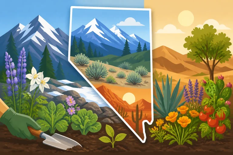
This distinction matters across Nevada. A statewide map may show broad patterns, but neighboring areas can experience different growing conditions because of elevation, terrain, exposure, and local weather. A zone lookup is a starting point for a location, not a complete description of its climate.
How to look up a Nevada location
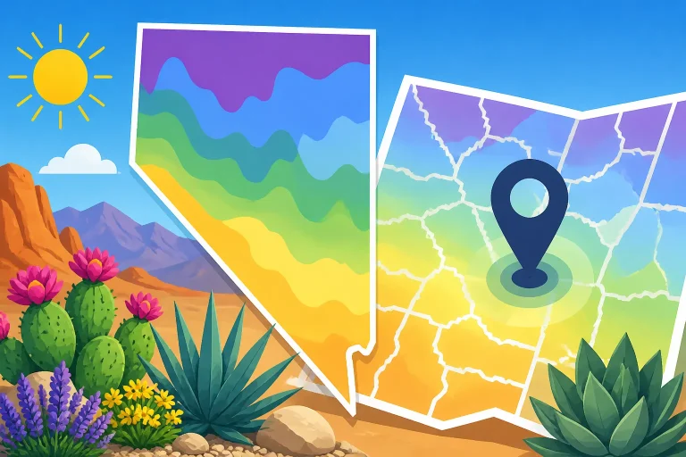
The USDA map includes a search tool for locating a Plant Hardiness Zone. The USDA Agricultural Research Service explains that gardeners can enter your zip code in the Quick Zip Code Search box to find a location’s Plant Hardiness Zone. The result can help you orient your plant search, but it should not be treated as a precise guarantee for a specific garden bed.
For a useful lookup, start with the location where the plants will actually grow. A ZIP code represents an area, and conditions can vary within it. If you garden outside a town center, at a different elevation, or in terrain that differs from the surrounding area, consider the result a broad reference. Do not assume it captures every feature of your property.
A practical lookup involves more than recording the zone shown on the map:
- Search for the ZIP code nearest to the garden location.
- Note the map result as a general reference for winter hardiness.
- Compare that result with the hardiness range listed for each perennial you are considering.
- Check whether the garden site differs from the surrounding area in elevation, slope, exposure, or shelter.
- Look for plant information about summer heat, water needs, soil, and sun as well as winter tolerance.
For a more detailed walkthrough of the search itself, see Finding Your Hardiness Zone With the USDA ZIP Code Map Tool. If a ZIP-code result seems too broad for your situation, How to Look Up Your Exact Nevada Growing Zone by ZIP Code can help frame the lookup question more closely. Even a more precise map result remains a regional estimate rather than a promise about one planting spot.
Keep a short record of the result alongside the plant information you use. It is helpful to note the location searched, the plant’s stated hardiness range, and any important differences between the mapped area and the garden. This makes it easier to compare potential plants without mistaking the zone for a full planting plan.
If you are selecting plants for more than one part of a property, assess those areas separately. An exposed garden edge, a sheltered courtyard, and a low spot may have distinct conditions even when they share the same map result. A single ZIP code lookup cannot represent every microclimate within a yard.
Do not try to infer a zone from a general description such as “northern Nevada” or “high desert.” Those terms cover varied locations. Use the map for the location you want to evaluate, then account for local conditions that the map cannot show.
Why Nevada’s local conditions still matter
Nevada’s varied terrain makes it especially important to look beyond a map result. Elevation, slope, exposure, and nearby structures can influence how a planting site experiences winter and summer. Two gardens in the same broad region may not have identical conditions, and a single property can contain noticeably different growing environments.
Elevation is one reason that regional labels alone can mislead. Higher sites and lower valleys do not share the same pattern of seasonal temperatures. Terrain can also channel cold air into low spots, while slopes and sheltered locations may behave differently. These differences affect how plants fare, but the hardiness map does not describe every detail of a yard.
A useful way to think about local variation is to compare the map result with what the site is like:
- Exposed or sheltered: Open areas can face more wind and weather exposure than places protected by buildings, fences, or vegetation.
- High or low in the landscape: Cold air can settle in low areas, while the conditions on a slope may differ.
- Sunny or shaded: Sun exposure changes how quickly a site warms and how much heat plants experience.
- Dry or well supplied with moisture: Water availability and soil drainage affect plant health, even when winter tolerance is suitable.
- Near hard surfaces or open ground: Walls, paving, and other surfaces can change local heat and exposure.
These are not reasons to disregard the map. They are reasons to use it as one layer of a decision. For more on the relationship between a mapped zone and other site conditions, see Growing Factors Beyond USDA Hardiness Zones in Arid Nevada Gardens. For an overview of how regional elevation and local exposure complicate a statewide view, see Nevada Regional Planting Guide: Elevation and Microclimate Shifts.
When a plant is borderline for the zone shown, local conditions deserve extra attention. A sheltered position might reduce exposure to harsh conditions, but it cannot make a plant suited to every other aspect of the site. Likewise, a sunny, protected spot may still have dry soil or intense summer heat. Evaluate the plant’s complete needs rather than assuming one favorable feature cancels out another challenge.
Gardener observations can add context, especially when they are specific to the site. Notice where cold-sensitive plants struggle, where snow or water tends to collect, and which areas warm early. These observations do not replace a map lookup or reliable plant information, but they can help explain why a plant performs differently from what a broad zone label might suggest.
For a closer look at why elevation and frost timing can be more useful than a hardiness zone when planning seasonal work, see Why Elevation and Frost Timing Matter More Than Plant Hardiness Zones. That distinction is especially helpful when moving from perennial selection to vegetable sowing dates.
How to use a zone when choosing perennials
Start by checking the hardiness information for the specific perennial, not just its common name or appearance. Similar-looking plants can have different tolerances, and labels may describe the conditions a plant needs in more detail than a broad garden category does. Compare the plant’s stated range with the map result for the intended location.
A match is a reason to keep considering the plant, not an automatic reason to buy or plant it. After checking hardiness, investigate the conditions that the map does not describe:
- Does the plant suit the site’s sun or shade?
- Can it handle the available soil drainage and moisture?
- Is it likely to cope with the site’s summer heat and exposure?
- Does it need shelter from wind or protection from reflected heat?
- Is the planting area large enough for its mature size?
These questions help prevent a common mismatch: choosing a plant because it appears to fit the winter zone while overlooking its growing-season needs. A perennial may tolerate local winter cold but fail to establish in an exposed, dry, or poorly drained location. Another may need a planting position that the yard simply does not offer.
Use the map to narrow options, then compare those options against local growing conditions. If a plant’s listed hardiness range includes the location, read the rest of its care information and decide whether you can provide suitable conditions. If the plant falls outside the stated range, treat that as a reason for caution. Do not assume that a sheltered corner will make a poor match reliable.
Plant labels and descriptions are starting points, too. They may not account for every Nevada microclimate or the particular conditions of a home garden. When information is unclear, look for advice about the plant in a comparable local setting and ask a qualified nursery or gardening professional about its suitability. A local recommendation is most useful when you describe the site’s exposure, soil, and water conditions rather than giving only a zone.
For a focused explanation of the role a zone can play in perennial selection, see Using Hardiness Zones to Pick Perennials That Survive Winter Minimums. The key is to read “hardy here” as a statement about winter tolerance, not as a guarantee of year-round success.
The map is also helpful when comparing choices. If two perennials suit the same light and soil conditions, their hardiness information can help you distinguish which is a safer fit for the winter conditions at the site. But a broader hardiness range does not necessarily mean a plant is the best choice overall. Water use, maintenance needs, mature size, and summer performance may be more important to your garden.
For new plantings, establishment conditions matter as well. A perennial that could survive an established garden’s winter may be more vulnerable while it is newly planted or developing roots. Consider whether you can provide appropriate moisture and protection while it settles in, and avoid assuming that a zone listing describes every stage of a plant’s life.
Why a hardiness zone is not a planting calendar
The most important limitation for vegetable gardeners is that the hardiness map does not provide planting dates. It is designed to help assess perennial winter survival. Vegetable crops are often managed for a particular harvest window and may be sensitive to spring freezes, summer heat, or the length of the growing season. A map result alone cannot tell you when to sow or transplant them.
A vegetable planting schedule needs to account for the crop and the local season. Cool-season crops and warm-season crops have different temperature needs. A date that is suitable in a warm valley may not be appropriate at a higher or colder site. The relevant questions include whether the soil is workable, whether temperatures suit the crop, and whether a freeze remains a risk.
Keep these decisions separate:
| Gardening decision | Useful information to consider |
|---|---|
| Choosing a perennial for winter survival | Hardiness information and the map result for the location |
| Sowing a vegetable | Crop temperature needs, soil conditions, and local seasonal timing |
| Moving a seedling outdoors | The plant’s sensitivity, current weather, and risk of cold |
| Planning a fall harvest | Crop development time and the expected end of favorable growing conditions |
| Selecting a site | Sun, exposure, drainage, water access, and local terrain |
If you are planning vegetables, use a regional planting calendar rather than translating a perennial zone into a sowing date. Nevada’s growing conditions vary, so a calendar that distinguishes growing regions and seasons is more useful than a statewide assumption. Nevada Vegetable Gardening Guide by Region and Season can help with that broader planning, while When Is It Safe to Plant After the Last Freeze in Nevada? focuses on the separate question of freeze risk.
Frost timing and hardiness are related to different gardening decisions. A perennial’s hardiness information is about whether it may survive winter cold over time. A spring freeze can damage tender new growth even if a plant is generally suited to the location. Conversely, a vegetable may be grown and harvested successfully in a season without being a perennial that survives winter outdoors.
Avoid using the zone as a proxy for the last spring frost or first fall frost. Those dates vary from year to year and depend on local conditions. Even a regional frost estimate cannot guarantee the weather in a particular garden. Use local freeze information and current conditions when deciding whether to plant sensitive crops.
This is why a zone can be accurate and still seem unhelpful for a vegetable question. It was not designed to answer that question. When the task is to time a planting, look for crop-specific guidance for the relevant Nevada region and season. When the task is to choose a perennial that may tolerate winter, the hardiness map is a sensible starting point.
When the map result and garden experience seem to disagree
A mismatch between a map result and what happens in the yard does not automatically mean the map is wrong. The map describes a broad location, while a plant responds to the conditions where it is rooted. Before changing your plant choices, look for a practical explanation.
First, confirm that you searched for the location nearest the garden. A ZIP code lookup may represent a larger area than the planting site. If the garden is outside the developed area, differs substantially in elevation, or sits in a distinct terrain feature, the lookup may not capture those differences.
Next, examine the planting spot. A low area can collect cold air; a windy edge can expose plants to harsh conditions; a sheltered courtyard can behave differently from open ground. Sun, reflected heat, soil drainage, and available moisture can influence survival and growth. Consider whether the plant struggled during winter or instead declined during the growing season. Those are different problems and may point to different causes.
Also check whether the plant was established and cared for appropriately. A plant’s hardiness range does not describe the condition of a particular specimen, its establishment, or every possible stress it may encounter. Poor drainage, drought stress, damage, or an unsuitable light level can contribute to failure even when the plant is within a potentially suitable range.
A simple record can make your observations more useful. Note the location in the yard, sun exposure, drainage, winter exposure, and how the plant changed through the seasons. If plants in one area repeatedly struggle while similar plants elsewhere do well, the difference may be a microclimate or site condition rather than the overall map result.
When considering a replacement, use that information to refine your selection. Choose a plant with suitable hardiness, but also match its light, water, soil, and heat needs to the site. If the same spot has repeatedly presented a problem, changing the location or selecting a plant adapted to those conditions may be more effective than relying on a map label alone.
Do not use one unusually mild or severe winter as the only measure of a site. The map is a broad planning reference, while individual seasons vary. Garden observations are valuable when considered over time and alongside the plant’s needs. If you need help diagnosing a struggling plant, seek advice from a qualified local gardening professional and describe the site conditions as well as the map result.
A practical way to apply the map in Nevada
Use the map as part of a decision sequence rather than as a stand-alone answer. This keeps the lookup useful without asking it to do jobs it was not designed to do.
- Define the decision. If you are choosing a perennial, winter hardiness is relevant. If you are timing vegetables, use crop and season guidance instead.
- Search for the planting location. Use the map’s ZIP-code search, then remember that the result represents a general area rather than every garden bed.
- Check the plant’s information. Compare its stated hardiness range with the map result, and read for other growing requirements.
- Assess the actual site. Consider elevation, slope, exposure, wind, sun, soil drainage, and water availability.
- Match the plant to the site as a whole. A suitable winter range does not compensate for unsuitable summer conditions, light, or soil.
- Use regional guidance for seasonal work. For sowing and transplanting, consult advice that addresses Nevada’s growing regions and local freeze patterns.
- Adjust based on observations. Keep track of how plants perform in different parts of the garden and use that evidence in future choices.
For example, suppose a perennial’s label indicates winter hardiness that appears compatible with the map result for the location. That is a reason to investigate the plant further. You still need to determine whether the intended bed has appropriate sun, drainage, and moisture, and whether the plant can tolerate the site’s summer conditions. If those needs do not match, the map’s favorable result will not solve the mismatch.
For a vegetable bed, the sequence changes. Begin with the crop and the season you want to grow it in. Then consult local planting guidance and freeze information, and assess soil and weather conditions before sowing or transplanting. The hardiness map may help with choosing perennial plants around the garden, but it does not set the vegetable calendar.
The most useful habit is to treat the zone as a question prompt: “Could this perennial tolerate winter conditions around this location?” Then investigate the rest of the plant’s needs. That small distinction helps avoid overconfidence, especially in a state where broad regions and individual garden sites can differ.
Use Nevada Weather Station Freeze Dates: Spring and Fall Guide when the question involves seasonal freeze timing, not perennial selection. For a broader look at gardening across different Nevada growing areas, Vegetable Gardening Across Nevada Growing Regions can help keep regional differences in view.
Frequently Asked Questions
Does a matching hardiness zone mean a perennial will thrive?
No. It suggests the plant may tolerate the winter conditions associated with the location. Sun, soil, drainage, water, exposure, and summer heat can still make the site unsuitable.
Can I use my zone to decide when to plant vegetables?
Not by itself. The map is useful for perennial winter hardiness, while vegetable timing depends on the crop, local season, soil, and freeze risk.
Should I rely on a ZIP-code result for every part of my yard?
Use it as a general reference. A ZIP code lookup may not reflect differences in elevation, exposure, terrain, or cold pockets within a property.
What should I do if a plant fails despite being listed as hardy for my location?
Check the planting site and the plant’s other needs before concluding that the zone was the problem. Review drainage, moisture, sun, exposure, establishment, and the conditions under which the plant declined.
Sources
- USDA Agricultural Research Service — 2023 USDA Plant Hardiness Zone Map | USDA Plant Hardiness Zone Map (checked November 15, 2026)
Disclaimer
This article is for general informational purposes only and does not constitute professional advice. Laws, prices and regulations vary by location and change over time. Consult a qualified professional for guidance on your specific situation. Nevada Gardening Guide is not a government agency and is not affiliated with any university extension, state department of agriculture or other government agency.